

Tarbert Approach
Just went to dig into the recent photos from Scotland and rather than continue with the grey day tour around southern Harris, thought I’d go back to our first day when we headed for Luskentyre Beach.
We were lucky to be able to gain access to our holiday accommodation early, so from Stornoway, we headed to Tarbert, the point on Harris where the eastern sea loch almost meets the Atlantic. This is also the point that divides North and South Harris.
The road is a really good road, providing great views as it traces its way through a largely barren landscape of heather, rocks, and water. Before reaching Tarbert it suddenly emerges for the first time on the western coast.
I had to pull into a side road, reach for the camera and take the pictures below.
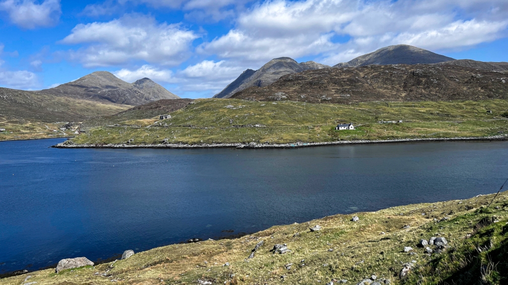
We’d have to wait a few more days before we would see so much blue in the sky again.
The photos are taken looking in a generally northern direction, an area that claims to have the highest density of breeding golden eagles in Europe*. It is easy to see why; sparsely populated, rocky crags and plenty of prey, judging by the rabbit burrows we came across.
No matter which direction one looked from this point, the scenery was stunning; a bright blue sky dotted with cotton ball clouds was undoubtedly a factor.
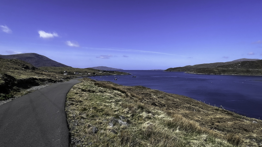
The next land point in this direction is North America. The hill on the horizon, just to the left of centre, is the island of Taransay which sits just off Luskentyre Beach. From here it appears to be just a short boat ride away, but by car, the sinuous road journey covers a distance of around 13 miles (21 km). A journey with plenty of opportunities to stop and take photographs, depending upon the weather,,,,
- Source: The North Harris Eagle Observatory
Source link


